The Victorian Guide Book
One of the interesting developments of the Victorian age was that of the guide book. Facets of today's guide books had appeared in England much earlier, indeed John Norden's triangular table of distances for each county - a must for any modern guide book - first appeared in 1625, to be reprinted complete with county maps by Matthew Simmons in 1636 (9). Many of the county books produced before 1770 were also topographical with accounts of the geography and history of the area and often with their text taken from Camden’s Britannia published in 1586 with but one map1. However none were arranged in the manner we would expect to find in a typical guide book; an up-to-date map of the area and of towns along a recommended route with information on things to see and places worth visiting.
The earlier road books of the seventeenth and eighteenth century followed John Ogilby (1675) showing only the single road in strip form with its junctions, bridges and hills. Owen and Bowen in 1720 took the strip form a step further when they added county maps (24) and descriptions of towns and places. One or two other writers began to introduce places to visit; for example, Francis Grose in his 1787 Antiquities gave a list of those in this county worth notice but the maps, reprints of John Seller's 1694 originals (20), were not exactly up-to-date and had no roads.
It was not until 1771 with the publication of Daniel Paterson'sNew and Accurate Description of the Direct and Principal Cross Roads in England and Wales that a book described the actual route. He followed this in 1785 with his British Itinerary which included a full set of road strip maps (to be revived by Gall & Inglis in the late nineteenth century). In 1789 Cary's Traveller's Companion (55) was published and this included for the first time county maps which showed all the main coach and post roads. John Cary followed his Companion in 1798 with his New Itinerary, ideally to be kept, if not bound, together.
These two Itineraries were sophisticated road books. Although very dry for today’s readers, each combined volume included a map of Great Britain, an index of all main routes from London with branch roads and cross roads, lists of coach routes, inns and staging points on the way, giving the traveller a complete picture of the route, local estates and houses, with descriptions of the principal towns and local history.
Bulky works by anyone's standards, Paterson's and Cary's works were colossal achievements compared to their forerunners. Even so they remained very much a route book, one where the route to be taken is the focal point, rather than the sightseeing along the way. Not until 1805, with G A Cooke's Topographical Survey (68), was it possible to purchase handy, pocket-sized guides incorporating a road map of the county. His County series was available as individual volumes or in groups of adjoining counties. The Topographical and Statistical Description of the County of Devon included an itinerary of the roads, a description of the rivers, agriculture etc., accounts of the main towns and a small pocket-sized map of the county. This was the first guide book with the emphasis on scenery rather than the road. It was followed by a number of dictionaries or gazetteers which, in the manner of an encyclopedia, listed all towns and villages in alphabetical order, often including maps of each county; Fullarton'sA New and Comprehensive Gazetteer of 1833 with Scott's map of Devon (107) or Lewis' A Topographical Dictionary of England of 1835 with maps by Creighton (113) are good examples.
As John Vaughan writes2: the period of the formation of the English guide book, roughly 1780 to 1870, coincided with the revitalising of cartography in England. The Ordnance Survey was established in 1791 and in 1801 produced the first of its one inch county maps, a series completed by 1867. Some guide book proprietors saw the advantage of the work of the Ordnance Survey and sought to use Survey material in their own publications.3
This is perhaps too general. The earlier Cooke's maps were specially drawn and engraved and Scott and Creighton produced county maps for their gazetteer and dictionary respectively. In the tradition of cartography many of these maps were copies of earlier work and not of new material. But both Paterson and Cary surveyed the roads and Cary's maps and itinerary were commissioned by the Post Master General and were original maps. We must remember, too, that Cary's Traveller's Companionwas in its second form in 1806 (69) three years before the second ordnance survey map, Devon, was issued. Yet, true to form, when and if maps contained new and up-to-date information it was highly likely that they had used the Ordnance Survey as source material.
Among the earliest local guide books is A View of Plymouth-Dock, Plymouth and the adjacent Countrypublished by A Granville & Son of Plymouth in 1812 complete with a map by Neele. It was followed by The Tourist's Companionpublished by Longman, Hurst, Rees, Orme and Brown in 1823 which contained the same map. Not only does it contain one of the first directories in Devon but it also refers the reader to one of its primary sources The Beauties of England and Walesby John Britton and Edward Brayley, published in 1809 and accompanied by Cole and Roper's county map which had been especially produced for the issue in 1805 (67).
Among the first publishers to claim, or admit, the use of Ordnance Survey maps were the Croydons of Teignmouth. One of their earliest illustrated works4 was A Guide to the Watering Places between the Exe and the Dart. This was published in 1817 with a map published by special Leave, from the Honourable Board of Ordnance. Other guides, printed and published by the same company, approached the guide book format we would expect today. The Teignmouth, Dawlish, And Torquay Guide with an account of the surrounding neighbourhood was one of the earliest guides conforming to a modern-day format. Probably written by N T Carrington (whose name is on the cover) it was published by Edward Croydon. He and George Croydon were the owners of the news, reading, and billiard rooms at their public library in Teignmouth. The volume included lithographic views5 and a map By Special Permission from the Right Hon'ble The Board Of Ordnance. 6 It was published in 1830 as Volume I of the Guide to The Watering Places, and was followed by The Torquay Guide which reached a third edition in 1848.7 It is to Henry Besley that we must look for the first county 'guide' book of Devon. His Route Book Of Devon was first published c.1845. It, like the local guides, broke away from the old topographical dictionary style and, arranged by routes centred on Exeter, was designed for the 'tourist'. Few local printers published extensively but Henry Besley of Exeter could probably claim to have been the most prolific printer and publisher at the time. Although Tooley8 lists only two cartographical works, one must presume that Besley was responsible if not for the survey (there was probably none) but for commissioning the printing of all those maps published with his imprint (nine to date). The Besleys were important local publishers: Thomas Besley (1760-1834) and his son Thomas Junr (1790-1853) were registered in Exeter as printers as early as 1827. They published directories of the westcountry from 1828 and a map of Exeter in the same year. Henry Besley, the second son (1800-1886) was listed in both White's and Martin's Directories of 1851 and 1857 as printer, stationer and publisher of almanacks and guide books at 76 South Street. His son Robert Henry joined the firm in 1873, listed in White's Directory (1878/9) at 89 South Street as printers, booksellers and stationers, and Besley's Post Office Directory of Exeter and Suburbs was being produced from the same address in 1897. By 1898 the firm had become Besley and Dalgleish and Besley & Copp Ltd was still a well-known firm of printers in 1912. In addition to their popular illustrated guide books and directories which invariably included maps, they also produced other maps including special folding maps, such as Dartmoor (2 variants known, drawn to a scale of 6M to 100 mm). In 1854 they issued a Devon, Cornwall, Somerset and Dorset Almanack, in 1855 a Route Book of Cornwall, and in 1858 they acquired the Exeter Journal (93).
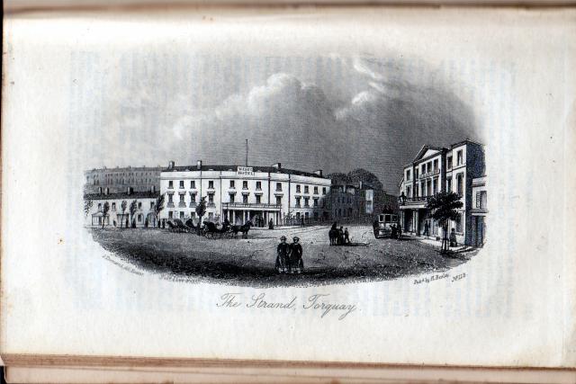
Typical Besley vignette – Torquay, Strand
(note the Durnford Sisters in the foreground!)
The Devon Route Book was reprinted several times until the late 1870s. Reminiscent of Cary's itinerary with its roads out of London, The Route Book suggested fourteen roads out of Exeter and described each route in detail. With fine engravings by G Townsend (and later by S R Ridgway) and specially produced maps and plans it was the forerunner of the county guides to be followed later by the leading guide book producers. The engravings were often sold separately in booklets of twelve or more prints and are popular with print collectors. Ward & Lock proceeded to use Besley maps from c.1886 in their Shilling Pictorial Guides
Two further early examples of local publishing were both produced by clerical writers9; The Panorama of Plymouth or, tourist's guide to the principal objects of interest, in the towns and vicinity of Plymouth, Dock, and Stonehouse and A Picture of Sidmouth. The former was written, printed and published by Samuel Rowe (1793-1853) in 1821 and is a good example of a thorough local guide covering most topics succinctly and authoritatively. First apprenticed to a bookseller, Rowe’s father bought a business for him and he was able to devote his time to writing. He became secretary of the Plymouth Institution in 1821. In the following year he was ordained, held livings in his home county and continued his topographical interests. The other volume was by Edmund Butcher (1757-1822), a Unitarian minister. Poor health forced him to retire to Sidmouth, where he lived for many years producing sermons and the local guide. A fourth edition appeared in 1830 with the new title A New Guide, Descriptive of the Beauties of Sidmouth.
The first recorded mention of the term guide-book is to be found in Lord Byron's poem Don Juanin 1823. Earlier writers had used survey, panorama or picture but the word guide quickly caught on and Croydon and others proceeded to use it regularly as we have seen. Besley preferred Route Book and indeed many other writers used the idea of the route to plan the descriptions of those sights worth seeing. Another term that became popular from 1850 was Handbook10, a term created by John Murray II and later adopted by his great rival, Nelson's, and then by Thomas Cook & Sons.
The two most famous names in the history of the genre of the guide book must be those of Murray and his continental rival, Karl Baedeker (1801-1859). Dissatisfaction with existing guides was Murray’s motive for producing his new publications. In an article in Murray's Magazine for 1889 John Murray III explained how sixty years earlier he had brushed up his German and set out to tour Europe but found the only Guides deserving the name were: Ebel, for Switzerland; Boyce for Belgium; and Mrs Starke for Italy. Hers was a work of real utility, because ... it contained much practical information gathered on the spot.11
Murray's (1778-184312 famous series of red-bound guides began in 1836 with a general guide to European countries and by 1855 there were Murray guides to most places worth visiting. However, it was his son, John III (1808-1892) who had the idea for the entire series and who wrote some of the first guides. Murray’s guide to Devon and Cornwall was his first county guide. It appeared in 1851 with the Devon map by J & C Walker (116) and by 1899, when Warwickshire was published, there were some sixty volumes. An impressive tribute to their popularity was the recognition by Baedeker. His first Handbook, to Holland and Belgium, appeared in 1839; in the preface he wrote that Murray's Handbook for Travellers on the Continenthad formed its basis and some of his later works also contained acknowledgements to Murray.13 The Murray guides were so good that Professor Jack Simmons when writing about some twentieth century guide books wrote that Murray's Handbook of 1851 is still, from many points of view, the most profitable guide-book to use in Devon and Cornwall in 1951.14
Murray's first three editions of Devon & Cornwall contained the two Walker county maps. The fourth edition, revised by T C Paris,15 contained a new map of Devon by W & A K Johnston (135) which was included in the the fifth, sixth and eighth editions (there was probably no seventh edition). Murray liked to use local writers as much as possible and these later editions were revised by Richard John King (1818-79). King came from Plymouth and studied at Exeter College, Oxford. He not only carried out revisions to a large number of these guide books but he also contributed to other works including the Encyclopaedia Britannica published by A & C Black. A well-known historian, King became President of the Devon Association; he died at Crediton in 1879. Each edition was extensively revised and Murray employed other writers such as the Rev. H S Wilcocks, C Worthy and W O Goldschmidt. They brought the guides up to date and banished some of those minute details interesting only to the antiquary and those portions of the legendary lore which appeared so trivial (Ninth Edition) or they introduced many facts which recent investigations or church restorations have brought to light (Tenth Edition). Many editors of Murray’s Hand book were local people: the Rev. Horace Stone Wilcocks, who contributed to the Devon issue of 1879, was born at Exeter (1835) became Vicar of St. James-the-Less church in Plymouth, resigned after a dispute with the Bishop of Exeter and died in Plymouth in 1912; Charles Worthy, paid £10 for corrections to the 9th edition and £52.10.0 to edit the 10th edition, was born at Exeter. Another contributor to the guide of 1879, and to the Cornwall Handbook of 1882, was Sir John C B Milton, a cousin of Anthony Trollope, he was awarded his knighthood for services during the Crimean War.16
The 9th, 10th and 11th Murray editions (1879, 1887 and 1895) separated Devon from Cornwall. Strangely Murray chose to use Walker maps again in the 9th and 10th Editions, possibly as they were more detailed than the W & A K Johnston map, but the Eleventh Edition had a larger, more detailed map by Bartholomew (149). When John Murray III died in 1892 the company was facing strong competition not only from the Blacks and Dulau but also from Baedeker. John Murray IV finally sold the series (excluding Japan and India) to Edward Stanford in 1901.17
Murray's greatest domestic rival was probably the Edinburgh firm of Adam & Charles Black. Adam Black (1784-1874) established the business in 1807 bringing his nephew Charles (1807-1854) into the firm in 1833.18 Black's Economical Tourist of Scotland appeared in 1826 and the first of Black's popular series of guides (most of them written and revised by the family)19 appeared in 1839 with the publication of guides to Edinburgh and Glasgow. The series progressed and in 1841 the first regional guide to the English Lakes appeared and two years later a guide to England and Wales. The series then expanded steadily, at first with city guides then with county guides from c.1855 including Devonshire.20
Unlike Murray, who strived to keep his guides up-to-date, the Blacks do not appear to have had such ambitions and the early editions of their guide to Devon remained virtually identical as far as the text is concerned. From the start they combined counties. Devon and Cornwall appeared in 1855 (130) and in 1862 Devon, Dorset and Cornwall. The later Devonshire volumes retained the pagination of the combined 3-county volume. Blacks’ 1862 guide (the three county volume) contained a map of Dorset, Devon and Cornwall produced by Bartholomew from plates of a larger regional map (142). Devonshire appeared the same year and the map was taken from the same plate showing either Devon alone or Devon and Cornwall together. Extensive revisions were carried out and editions after 1882 included a larger map, again drawn and engraved by Bartholomew; the same map that was issued in Murray's 11th Edition (150.16). The pages were renumbered and for the first time Devonshire starts on page 1 - twenty years after its first appearance! In 1892 further revisions were carried out, probably by Charles Worthy of Exeter. He had served in India and took up studying antiquities when invalided out of the army in 1864. He lived at Heavitree, contributed to the Devon issues of Murray's Handbooks of 1879 and 1887, and also wrote Devonshire Parishes in the Archdeaconery of Totnes.21 A phenomenally successful series, Black’s Devonshire was reprinted almost annually until the end of the century.
After Blacks' success in publishing a guide to the three south-western counties of Cornwall, Devon and Dorset followed by the guides to each of the counties it would have seemed reasonable to follow with individual guides for the tourist resorts, or at least areas. Yet it took them forty years to realise that there was a growing market for such guides and only in 1901 did Black's Guide to Torquay and the South Hams, Paignton, Dartmouth, Totnes, Kingsbridge, Salcombe, Etc. appear, priced sixpence and in paperback format.
Like the previous guides, the Blacks put little investment in the new series. Just as their original Devonshire text remained virtually unchanged from 1862 to 1881 the new Devon series remained but little changed until the end of the century, and the guide to Torquay was no exception. The Preface warns the reader that The bulk of these pages make part of our general Guide to Devon, which accounts for what may seem the irregular pagination of this section, in which pp. 9 to 65 come to be omitted. The text is a virtual copy of that found in the Devon volume published in the same year. Four maps were included: The Map of Torquay that had appeared in the last two Devon books; sectional maps of Torquay District and Dartmoor District (also from the Devon guide) and the county map, minimally revised, was that used for the Encyclopaedia Britannica in 1877 (153).
In 1878 and 1879, possibly inspired by the successes of Murray and Black, Edward Stanford published two guide books covering north and south Devon (154). The editor, Richard Nicholls Worth (1837-1896), was a popular Devon journalist, geologist, author and editor. His books included a History of Devonshire, other local histories such as Devonport, sometime Plymouth Dock, or History of Plymouth from the earliest period to present time and other county guides such as Somerset and Dorset. His Tourist’s guides to North and South Devon were very popular and were reprinted until 1894 in six editions with the same maps by Edward Stanford.
One other book publisher of county guides was fairly successful. Dulau & Co. began to publish from 1882 their two companion Thorough Guides to North Devon and North Cornwall and South Devon and South Cornwall. These also included sectional maps by Bartholomew, transfers from earlier Bartholomew plates which later appeared in the Royal Atlas, and were not maps of the whole county. However, like Blacks’ the guides also had a key or index map printed on the inside front cover to help tourists. These guides were also very popular and ran to many editions through the last years of the century. The first volume of the series, English Lake District, is notable as here John George Bartholomew effectively introduced layer colouring into Britain (in the sectional maps).22 Both Devon volumes were written and/or edited by M J B Baddeley and C S Ward (and included layer-coloured maps from 1895).
Another company to exploit the growing leisure market was Ward, Lock and Co. Some time around 1886 they produced their first guides to Devon. These were issued for local areas or bound together as North Devon or South Devon illustrated guides. Originally these contained copious engravings and woodcuts, but these were replaced by photographs in the 1890s. The map of north or south Devon that accompanied these guides to the end of the century were those of Besley (134) first published in the Route Book Of Devon. The Red Guide series continued and guides were produced into the second half of the twentieth century with transfers of John Bartholomew's maps of 1895 (174) still being used to provide area maps.
There were other guides written throughout the period including many local guides with sectional maps, but few were as successful as those printed by the major publishing houses. Concurrently ephemeral works appeared such as Ferny Combes by Charlotte Tranter. Half guide book and half personal experiences, Ferny Combes was illustrated with ferns of the area and included a specially produced county map (131). Mackenzie Walcott's Guide to the Coastswas also published with a county map (137). These were never as popular: the former was printed only three times and the latter once as an omnibus edition (of the whole of the south coast) and once as a mini version (Devon and Cornwall). A local writer towards the end of the century, John Ward Page, wrote three books on Devon: The Coasts of Devon; The Rivers of Devon; Dartmoor (and a book on Exmoor). As far as is known none were reprinted but they are good descriptions of the countryside written in guide style and each contains a map. One guide book, frequently reprinted, was Arthur Norway's Highways and Byways in Devon and Cornwall. Appearing in 1897, it was reprinted in 1898 and 1900 and several times in the twentieth century, appearing as a pocket edition in 1923.
Two popular local guides that deserve mention are The Hand-Book to South Devon and Dartmoor and The North Devon Handbook. The author of the first was William Wood, a publisher with premises in Devonport. He published a great number of local guide books including ten editions of the Hand-Book of Devonport, the Three Towns’ Almanack, from 1860 until 1896, Rambles and Excursions (Plymouth) and the Handbook to Cornwall (in 1880). All were illustrated with maps. The first two editions of the South Devon handbook included a close copy of the Ebden/Duncan county map first published in 1825 (95) but with a new title Devonshire From A Recent Survey With The Railways (129A) and changes to the arrangement of hundreds, addition of railways and the imprint Published by W. Wood No. 52 Fore St. Devonport. However, when it was reissued it only included a map of the southern part of the county.23 Later copies of the almanack also contained a smaller map of South Devon, probably drawn and engraved by W G Cooper, who was an engraver and lithographer with premisers in Union Street, Stonehouse.
Interestingly this would seem to be the first map of the county that showed the new Eastern boundaries. In an exchange of 1842 the parish of Thornecombe (the enclave in Dorset) was transferred to Dorset and the parishes of Stockland and Dalwood (the isolated parts of Dorset in Devon) were transferred to Devon. In 1844 the parish of Maker, at the mouth of the Tamar was transferred to Cornwall. There was a second eastern exchange in 1896 when Churchstanton was transferred to Somerset and Chardstock and Hawkchurch transferred to Devon.24
The second publication The North Devon Handbookedited by the Rev. George Tugwell was published by both a London firm, Simpkin, Marshall & Co. and a local Ilfracombe firm, John Banfield. The original work contained a map of north Devon signed by W Gauci. The Gauci family lived and worked in London but possibly had associations with the westcountry. M Gauci was a lithographer of costumes, portraits and topographical views. His two sons, Paul and William followed in his footsteps.25 They both made many excursions to the westcountry and produced plates for J Banfield’s Scenery in the North of Devon (c.1837). Paul produced plates for R Woodroffe’s Views in Bath (c.1840). William produced many more plates including those for G H P White’s Four Views on the River Dart (c.1830), J Baker’s Views of the Landslip at Axminster (1840), C F Williams´Six Views of Berry Pomeroy (c.1840) and one for Rev. G Tugwell’s The North Devon Handbook (c.1855), the other thirteen or fourteen illustrations were by or after W Willis. The Rev. Tugwell also produced The North Devon Scenery Book which was illustrated by H B Scougall with eight litho plates (2nd Ed. c.1863).
The first edition of Tugwell's The North Devon Handbook contained a map of the north coast.26 This had, across the top, a Section from the Foreland to Morthoe Hill’ showing the geological strata from Henry De la Beche’s Report. Subsequent issues always included a copy of a map originally published by Besley and son as Besleys' Plan of Ilfracombe and Lynton. In c.1865 Banfield's guide became Stewart's Shilling Guide Book to North Devon New Edition (Ilfracombe, W Stewart)27 and c.1872 as Milligan & Co.'s (Late Stewart's) Shilling Guide Book to North Devon New Edition (Ilfracombe, Milligan & Co. until c.1879).
A competitor to Henry Besley at the end of the nineteenth century was Thomas Doidge. A map of South Devon was issued by Doidge and Co., a local Plymouth firm. Doidge’s Western Counties Annual - a miscellany of useful, instructive and entertaining local and general information - was issued annually from c.1877 from their premises at 169-170 Union St. The Annual was produced in two editions with a special printing for the Army and Navy edition, which included county historical information in the calendar section. The annuals were packed with stories and contained an almanack for each month. Doidge advertised himself as Great Book and Stationery Mart and also as a Discount Bookseller. In 1879 Thomas Doidge was still registered at this address but the company was advertised as photographic studio, fancy goods dealers, booksellers, binders, stationers, &c.
In 1892 Simpkin, Marshall, Hamilton, Kent & Co. became their London agents. Photos were added in 1893 and by 1894 Doidge were claiming sales of fifteen thousand copies. The printers at the end of the century were the Plymouth firm of Hoyten and Cole.28 A map was included in 1899 - Midland Railway Map of Great Britain.
The map of Devon, Doidge’s New Large Scale Cycling and Touring Road Map, shows the area from St Austell to Teignmouth and north as far as Stratton and Bradford by Black Torrington. Railways are shown to Holsworthy, opened in 1879, but not the line to Kingsbridge which opened in 1893 nor the extension to Bude (1898 though planned earlier).29
There were a great number of local guides yet it was the major publishers and especially Murray and Blacks who made the guide book popular and, through their support and marketing, the guide book in its present form had arrived and was here to stay.
Although the majority of Victorian works containing maps of the county were dated many were still published with no date on the title page. Collectors must also be wary of the dates on the title page, especially during the latter half of the century. There are ways to date such works: the accompanying text may include helpful dates of recent events; advertising may be dated or contain a reference to another contemporary work; the evolution of the railway is a also a guide, though this may be misleading as lines optimistically included on the maps were not necessarily built.
From the 1860s guide book publishers often included advertisements at the back of their volumes and the discerning reader can spot dates embedded there, especially in those giving railway information.30 For example, Murray's Third Edition (1856) of the Handbook to Devon & Cornwall had no advertisements but in later copies of the Fourth Edition (first published 1859) there is a 24-page section with a separate title page Murray's English Handbook Advertiser 1860, showing that the guide was reprinted the year after the first publication but still with the original title page and date. Black's Guide To Devonshire 1868 has no adverts; that of 1869 a 48-page section with a separate title page Black's Guide-Book Advertiser 1869. The inside and back covers should also be inspected as these, too, can be dated. The inside back cover of the two Black's guides mentioned above are dated and not dated respectively. A copy of Murray's Handbook to Devonshire Tenth Edition, in the author's possession, is dated 1887 on the title page, dated on the inside covers as February 1892, yet has an advertising section for 1892-1893.
Although guide books flourished in the second half of Victoria's reign, many of the books have lost their maps and it is surprising how few guide books are available to enthusiasts and researchers in public libraries and museums although they regularly appear at antiquarian book fairs. The authors have included many of their own guide books for the purpose of completeness; often these are the only copies known.
[1] For example, John Speed’s county maps were published with an adapted Camden text (6), and in 1617 the so-called Miniature Speeds were published with a Latin version of Camden (4).
[2] John Vaughan; 1974; p. 81.
[3] Devon appeared in 1809 (74).
[4] With very good engravings by W B Noble.
[5] Drawn on stone by L E Reed or George Rowe and Printed by W Day, 17 Gate Street, London.
[6] However, the map, although claiming to be from the Honourable Board of Ordnance was possibly a copy of part of Cary's map of 1807.
[7] Mr S A Croydon was managing director of The Teignmouth Printing and Publishing Co. Ltd in Station Road, Teignmouth in 1930: Kelly's Directory.
[8] R V Tooley's original Dictionary of Mapmakersonly lists the Route Map of Roads, and a Plan of Ilfracombe (1892).
[9] John Vaughan; 1974; pp. 134-136.
[10] The spelling seems to be optional: the third edition for example had Handbook (on the title page), Hand Book (spine title) and Hand-book (cover).
[11] John Vaughan; 1974; p. 42.
[12] The firm was founded by John Murray (1737-1793). He printed his first guide in 1769: A Description of Bath by John Wood. John II is often erroneously credited with founding the company. John III introduced the famous red book series. See William Zachs; The First John Murray; OUP for The British Academy; 1998.
[13] John Vaughan; 1974, p. 47.
[14] J Simmons; Parish and Empire: Studies and Sketches; 1952; quoted in Vaughan, op cit.
[15] This edition pays tribute to one of Murray's early contributors: in the passage concerning Heavitree, near Exeter, "the residence of the late Richard Ford, who here wrote his celebrated Handbook for Spain.
[16] All biographies are taken from W B C Lister ( (1993).
[17] Under the terms of the agreement, dated 30th April 1901, Stanford bought up the stock and copyright of all other guides for £2000. The accompanying listing seems to indicate that a total of 321 copies of Devon were available. (Our thanks to Ms V Murray for providing us with a copy of the agreement.) The Royal Agricultural Society of England included a series of maps at infrequent intervals in its Journal between 1843 and 1870 published by Murray. There might have been the intention to publish a map of each county but Devon and 11 other counties were not included; a map of Exeter was, however, included. The maps are geological in nature showing various rock and soil strata.
[18] Adam Black is known to have visited Exeter in 1837 as part of a long selling trip. He arrived with just £5 in his pocket and had to borrow money for the return to Scotland. In Adam & Charles Black 1807-1957; A&C Black;1957.
[19] See Harold M Otness; Index to 19th century city plans ...; WAML; 1980; p. xv.
[20] John Vaughan reports the progress of Black's series of guides as beginning with (1839) Edinburgh, Glasgow;
1841, the English Lakes; 1843, England and Wales; 1850, London to Edinburgh; 1851, Wales; 1853, Trossachs; 1854, Aberdeen, Belfast, Dublin, Ireland, Killarney; 1855, Derbyshire, Devonshire, Hampshire. J Vaughan; 1974; p. 50 footnote.
[21] W B C Lister; (1993); p. 186.
[22] L Gardiner; 1976; pp. 30-33.
[23] SOUTH-DEVON with imprint: Engraved from the Ordnance Survey for the Hand-Book to South Devon. (CeOS). The area covered was from Rame Head to Lyme Regis and north to Chulmleigh. See Kit Batten's Tourist Maps of Devon entry Wood 3.
[24] W G Hoskins; Devon; Collins; London; 1959.
[25] Ian Mackenzie; 1988; p. 127.
[26] A Map of the NORTH OF DEVON AND PART OF SOMERSET. Published by John Banfield, Ilfracombe, 1856. Imprint: W. Gauci, Litho. 72 Gt. Titchfield St. London. See Kit Batten's Tourist Maps of Devon entry Banfield 5.
[27] This was originally Besleys' Plan of Ilfracombe and Lynton published by Besley and Son. Now has the title MAP OF THE NORTH COAST OF DEVON. First published by Banfield in 1868, later by W Stewart (1872) and again revised and subsequently reissued by Milligan (1879). The map shows the coast from Harland to Minehead and there are town maps of Ilfracombe, and Lynton and Lynmouth. See Kit Batten's Tourist Maps of Devon entry Banfield 7 and two entries for Stewart.
[28] Hoyten and Cole, 39 Whimple Sreet, Plymouth, were still active in 1930 when they were listed in Kelly's Directory.
[29] See Kit Batten's Tourist Maps of Devon entry John Cary - Thomas Doidge.
[30] One wonders what was more important: Black's Guide to Devonshire, for example, had 232 pages of text and a further 128 pages of advertisements by the time of its 16th edition in 1898.
